Conservation planning and assessment helps answer “where” questions related to trout and salmon populations to help inform, guide, and contextualize Trout Unlimited’s work.
Where are the strongest remaining populations for a protection focus? Where are the least disturbed habitats for a restoration focus? Where are the coldwater refuge streams for reconnection focus? Where can TU’s on-the-ground efforts achieve the greatest conservation benefit for the least cost? TU’s geographic information systems (GIS) experts deliver the results of our conservation assessments in the form of maps, reports, and decision support tools.
Conservation Portfolio and CSI
TU developed the Conservation Success Index (CSI) in 2010 to provide the first range-wide summary of watershed-scale information related to salmonid distribution, population attributes, habitat conditions, and future threats. The CSI approach has evolved into the Conservation Portfolio, which further evaluates populations based on their resiliency in the face of environmental disturbances, identifying key conservation actions for ensuring their long-term persistence.
Watershed, multi-species, and aquatic resource assessment
TU scientists and partners recently conducted research to help inform rules that determine which streams are protected under the Clean Water Act. In 2020 the new Navigable Waters Protection Rule eliminated federal protections for ephemeral streams – those streams that only flow in direct response to precipitation events, but which are important contributors to water quality and aquatic ecosystems; in enacting the rule the regulatory agencies failed to convey the impact of this loss of protection, attesting that the extent of these streams was unmappable and could not be quantified. Our novel mapping analysis estimates that these streams represent 43 – 56% of streams by length in the lower 48 states, and that roughly ½ of these features were previously protected in practice under the Clean Water Act. The Navigable Waters Protection Rule will likely result in increased degradation of US rivers and streams because a federal permit and associated requirements to avoid, minimize, and mitigate impacts will no longer be required for dredging, filling, or discharging pollutants into ephemeral stream channels. TU’s peer-reviewed and published research will support ongoing litigation and future revisions of the rule
Decision support tools
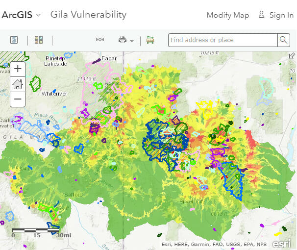
Web-based map and data visualizations take map content beyond paper cartography and data beyond figures and tables. TU scientists build these tools to help share data, put information in the hands of decision makers, and convey the motivation and results of TU’s work.
Recovery planning and risk assessment
Several species, subspecies, and stocks of native trout and salmon are listed as Threatened or Endangered under the Endangered Species Act. TU Scientists have worked with the recovery teams of various species to help bring science-based solutions to guide the recovery planning for native trout and salmon.


