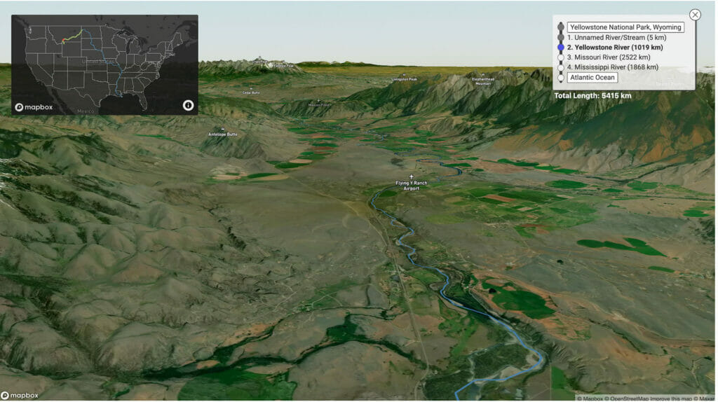


I’ve often wondered if some of the water running past me in rivers has been there before. What I mean by this is, has one single drop of water that has brushed my leg or boat made it all the way to the sea, evaporated, gone to the clouds and somehow made its way back to the same drainage? A silly thought for sure, and probably unlikely. But perhaps it’s happened.
Poking around the web the other day I stumbled across a project that could help figure out part of my theory by a gentleman named Sam Learner. At least visually that is. Sam is a “web and visualization developer, that puts together projects that help make public data more accessible.”
The project I stumbled across is called River Runner, and in Sams word’s, “uses USGS NHDPlus data and their NLDI API to visualize the path of a rain droplet from any point in the contiguous United States to its end point (usually the ocean, sometimes the Great Lakes, Canada/Mexico, or another inland water feature). It’ll find the closest river/stream flow line coordinate to a click/search and then animate along that flow line’s downstream path.
I’ve been playing with it quite a bit and must say it’s fairly addictive. If you’ve ever wondered where exactly your local creek or river goes after passes by you, give River Runner a try. Those of you in the coding know, check out Sam’s GitHub interface for running this code locally on your site. It’s very cool.