Light detection and ranging (LiDAR) data is helping TU’s restoration teams work more efficiently and effectively.
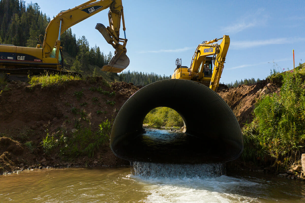
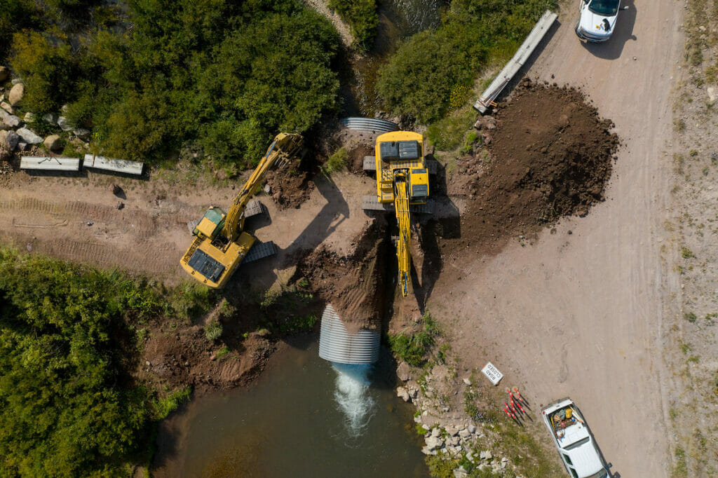
Removing barriers to fish passage is a big part of Trout Unlimited’s work across the country, but you might be amazed to learn how complicated finding culverts or low-head dams can be.
For years, TU staff has been heading out into the field to understand the landscapes and health of coldwater habitats to inform restoration work. While that is effective, it certainly isn’t efficient.
Typically, this was done by walking foot by foot up or down a stream reach. If that weren’t time-consuming enough, add in encountering these barriers and then crawling over or around them only to find another just ahead. Often, field staff would take what they found on the landscape back to their desks only to determine a particular reach an unlikely candidate for restoration. Talk about frustrating and sluggish work.
Enter technology
Dr. Chris Brehme, director of GIScience, specializes in geographical information systems (GIS) for TU. GIS is a database of geographic information where location is paramount that allows users to better visualize the landscape without having to be directly there through shifting conditions. Applying GIS to conservation questions like: Where are barriers located and do they adversely impact fish, or how do water diversions, degraded habitat, drought and more affect fish and what can we do about them, helps TU staff better understand the possible scenarios taking place and informing their restoration plans.
There are multiple tools that help Chris and his team apply technologies to just these sorts of questions. Satellite images give a sense of vegetation coverage and health. Flying planes, drones or helicopters equipped with LiDAR can provide precise elevations of terrain and forest canopy; however, water is difficult to map with the same precision due to reflection, refraction and turbulence, meaning we can’t rely on them solely thanks to the fact that we work on water. Drones can provide detailed elevation models of streams to really understand what is happening on the ground. A combination of these technologies plus getting staff on the landscape gives us a well-rounded picture of the barriers to stream flow.
There are approximately 6.6 million stream crossings in the U.S. and an unknown number of low-head dams, and part of TU’s work is to identify these problem barriers that don’t allow for fish passage. Luckily new funding from the federal government, and a push from the United States Geological Survey (USGS), is propelling just such technology to move forward to map these and other barriers. With a 10-year horizon line to the finish to map these across the country, it certainly can’t hurt for organizations like ours to help the cause by doing some of this mapping.
Applying the technology
Dr. Erin Rodgers and her colleagues in Vermont and Massachusetts have been using publicly available LiDAR data to better determine elevation changes on the landscape that might mean a low-head dam is obstructing a stretch. Prior to using LiDAR technology, they’d often get out onto the landscape to determine if a particular reach needed restoration only to find numerous low-head dams, or ghost dams. Even after rigorously checking state and county records, these dams kept popping up, which made their field time excruciatingly slow. Now using the LiDAR data, they can better quantify obstructions and know how many they are dealing with and with whom to discuss their possible removal. While the data is still coming in, this field season is sure to be more effective and efficient.
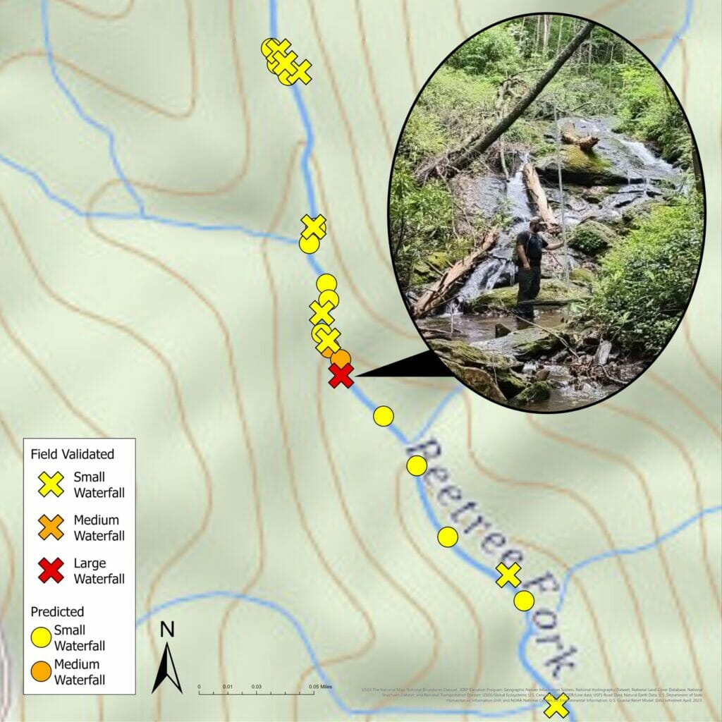
Jeff Wright is using LiDAR data for a different purpose in the Southern Appalachians. To continue TU’s efforts to restore native Brook Trout throughout their historical waters, Jeff is studying LiDAR data to determine if ideal streams or stream reaches for reintroduction exist. LiDAR is great at identifying waterfalls, and waterfalls are ideal for creating barriers between native and non-native fish species. He can also use this data to determine how long the reach is for reintroduction. If another waterfall exists just a quarter mile upstream from the first one, then maybe another reach is better suited.
In Colorado, Brian Hodge and his team used LiDAR data to develop the restoration design for First Creek. Located within the California Park Special Interest Area near Steamboat Springs, First Creek is home to a suite of native fishes, including Colorado River Cutthroat Trout, Mottled Sculpin and Mountain Sucker. In an effort both to maintain this taxonomic diversity and to restore degraded conditions, LiDAR was used to inform the restoration of First Creek’s floodplain. Moreover, LiDAR was integral to planning out the where and how of the First Creek restoration project. This project was but one part of a larger effort to reconnect nearly 40 miles of Cutthroat Trout habitat. If all goes as hoped, California Park will soon host one of Colorado’s most robust and resilient native trout populations.
Technology for the win
Ultimately, removing barriers helps fish, certainly, but removing them can help mitigate flooding impacts, control sedimentation, and provide a safer environment for humans and non, alike. TU’s science team is proud to help bring technology to the forefront to be better informed and work more efficiently and effectively. After all, if the habitat isn’t ideal nor connected, then fish nor fishing for our favorite trout wouldn’t be realized.