Welcome to TroutSpotter! This software uses AI to help people identify individual fish from your photos. While identifying your catch is exciting, it can also aid in determining fish migrations, recapture frequency and population numbers. In 2024, join our community science project in four target watersheds to help establish a groundbreaking fisheries management, scientific, and conservation strategy and learn more about your home waters!
Your catch locations are private to TU and USGS researchers and will not be shared – no spot burning! Your data will only be used for research purposes.
TroutSpotter is partially funded by generous support from TU’s Coldwater Conservation Fund.
Here’s how
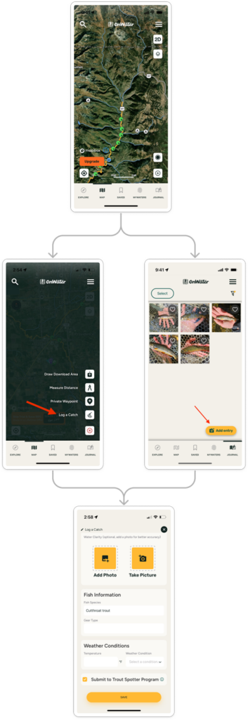
- Download the onWater Fish app and create a user profile (note that the TroutSpotter tool is a free service in this app).
- Enable “location services” on your phone. This will allow us to know where your fish was caught.
- Start fishing. Either record the start time in the app or turn on the tracking function (note this will be used by us but kept as private information, see below). This will help us understand how many fish are caught per hour.
- Catch a fish! When you are camera-ready, take a photo of the fish’s left side, showing as much of the spot patterns as possible. Be careful to keep the fish in the water until you are ready to photograph, and reduce its handling and exposure to the air as much as possible as you take your picture.
- Send the photo in the onWater Fish app (or save it on your phone to submit later). Don’t worry if your phone doesn’t have service, the onWater app will sync and submit your photos when your service returns.
- An AI system then learns the unique characteristics of your fish based on spot patterns and other individually diagnostic features and gives it a unique identification number.
- You can opt to receive notifications if and when your fish is recaptured in the future.
- Researchers with Trout Unlimited and the US Geological Survey will use the data to support conservation planning. These will take time to complete and depend on how many submissions we have in each focal watershed, but check back here periodically for updates and a leaderboard for most submitted photos and recaptures in each region!
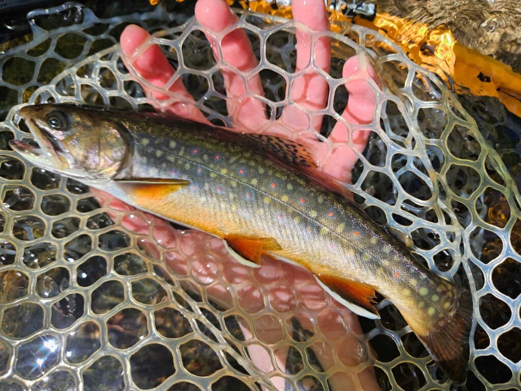
A properly handled and photographed fish
Here’s where
Rapidan River (Virginia)
Rapid River (Maine)
Deerfield River (Massachusetts)
Southwest Montana rivers
Stay tuned for new regions in 2025!
Other considerations
Your catch locations are private to TU and USGS researchers and will not be shared – no spot burning! Your data will only be used for research purposes.
Please use best-practices to minimize handling time and stress for fish.
Either iPhone or android devices will work.
Contact Helen Neville helen.neville@tu.org or Than Hitt nhitt@usgs.gov for more information about this research project.
Contact OnWater for assistance using the onWater Fish app.


